|
Castelnuovo di Garfagnana- Gragnanella- Sillicano- Careggine- Vergaia- Poggio.
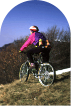
This itinerary is in part hard and goes through characteristic villages with wonderful views on the Apuan Alps. The decent to Vaglis lake is very exciting.
Time: 4.00 h Km: 22.
From the train station of Castelnuovo you go up the SR 445 to Piazza al Serchio; after 2 km you turn left to Antisciana, then you go on to Gragnanella and to Sillicano ( progressive 6,7 Km).
Now you go down to the tennis court of the village and then you take a small path that goes through a chestnut trees wood. At the end of the path you find the asphalt road that goes up from Poggio to Careggine.
When you arrive in Careggine you go through the historical centre and take the excavated road that go down to Vergaia; then you go through the Vaglis lake going by the dam. You go down to ferriera to reach the train station of Poggio or in alternative you can carry on by bike for 11 Km to return to Castelnuovo.
Barga train station-Gallicano- Trassilico- Fabbriche di Vallico- Turritecava- Ghivizzanos train station.
It is a very beautiful itinerary, hard in the first part, that goes through natural environment and wonderful views.
Time: 4.30 h Km: 37.
You start from the Barga-Gallicano train station, you turn right to reach Gallicano. Following the indication to Grotta del Vento you turn into a path that run alongside the torrent, till reaching le Crocette and the asphalt road which goes up to Verni and Trassilico, where you find a big 600 centurys fountain and you can do a little break.
Following the road that climbs to the cemetery the ridge is reached and from here, shortly the Foce della Pompanella (17,2 km) from where excavated road begins to go down the direction of Vallico Sotto. From here, shortly, Fabbriche di Vallico is reached. From the intersection you turn left the road that coasts along the stream up to the lake of Turrite Cava. After few bands, you reach the provincial road and, crossed the bridge on the Serchio, go up again to Piano di Coreglia and shortly the station FS of Ghivizzano is reached (point information and tourist reception).
Camporgiano-Casatico- Roggio Campocatino-Gramolazzo Ugliancaldo- Stazione di Monzone
Very binding itinerary .
TMP 6.00 Km. 45.
From station of Camporgiano, you climb to the village and the SR 445 that you follow on the right for 150 meters to take then a steep excavated on the left that climbs in direction of Casatico. Reached the village, you turn on the right thin to a great fountain; excavates now continues in the wood up to Roggio; another beautiful excavated brings you to Casa Tontorone, from where you enjoy one of the most beautiful panoramas on the northern Apuan Alps. The excavates now goes down, steep, toward the Giovetto, that marks the watershed among the lakes of Vagli and Gramolazzo. Here there is a deviation of around 1 kilometer to reach the green meadow basin of Campocatino under the wall of the Roccandagias mountain. When you come back to Giovetto, you go down to Gorfigliano and to the lake of Gramolazzo. Take the provincial road to Minucciano and, after the gallery, you have to take an excavated on the left and you follow this road up to the village of Ugliancaldo; now a hold asphalted road conducts to Mezzana, therefore to the station of Monzone-Monte dei Bianchi-Isolano.
Stazione di Monzone-Equi Terme-Il Solco-Equi Terme.
A small itinerary that allows you to penetrate in one of the most suggestive valley of the Apuan Alps of Lunigiana. From the station of Monzone, following the asphalted road, you reach the village of Equi Terme, where you can visit the cultural park and the caves. Here there is a marble road that penetrates in the Solco dEqui, a real canyon that finishes under the northern dizzy wall of Pizzo dUccello . You can catch the train here in Equi Terme, not without having taken advantage of a dive in the thermal swimming pool.
Il Tour del Monte Corchia.
A very binding itinerary of 22 Km, to be avoided in the winter period. From the roadway of Cipollaio, you follow the wide and asphalted road that brings up to Passo di Croce. From here the road becomes excavated and it alternates steep lines to others level up to Fociomboli. Now you have to leave the road that continues toward right and climbing over the ridge you begin to go down along a road closed by a tiller in direction of Puntato (trail sign n. 11 CAI). The layout is very steep for ca. 1 Km. then it continues to thin latch to a house to the summit of a basin of lawns where the road becomes a path. At this point it is necessary to go down for traces of path, up to the inferior border of the lawns arriving to the Church of Puntato, from where(still for trail sign n 11 CAI), you reach Col di Favilla. This part of the itinerary is binding, and sometimes you have to go on with the bike in shoulder. From Col di Favilla you can follow without excessive difficulties a steep excavated road that goes down in the wood and bring you to the carriage one coming from Castelnuovo G. near Isola Santa. Now you go up to the gallery of Cipollaio, where there is a limited illumination. At the end of the gallery you go down for ca. 3 Km. up to return to the point of departure.
|